Quick Start
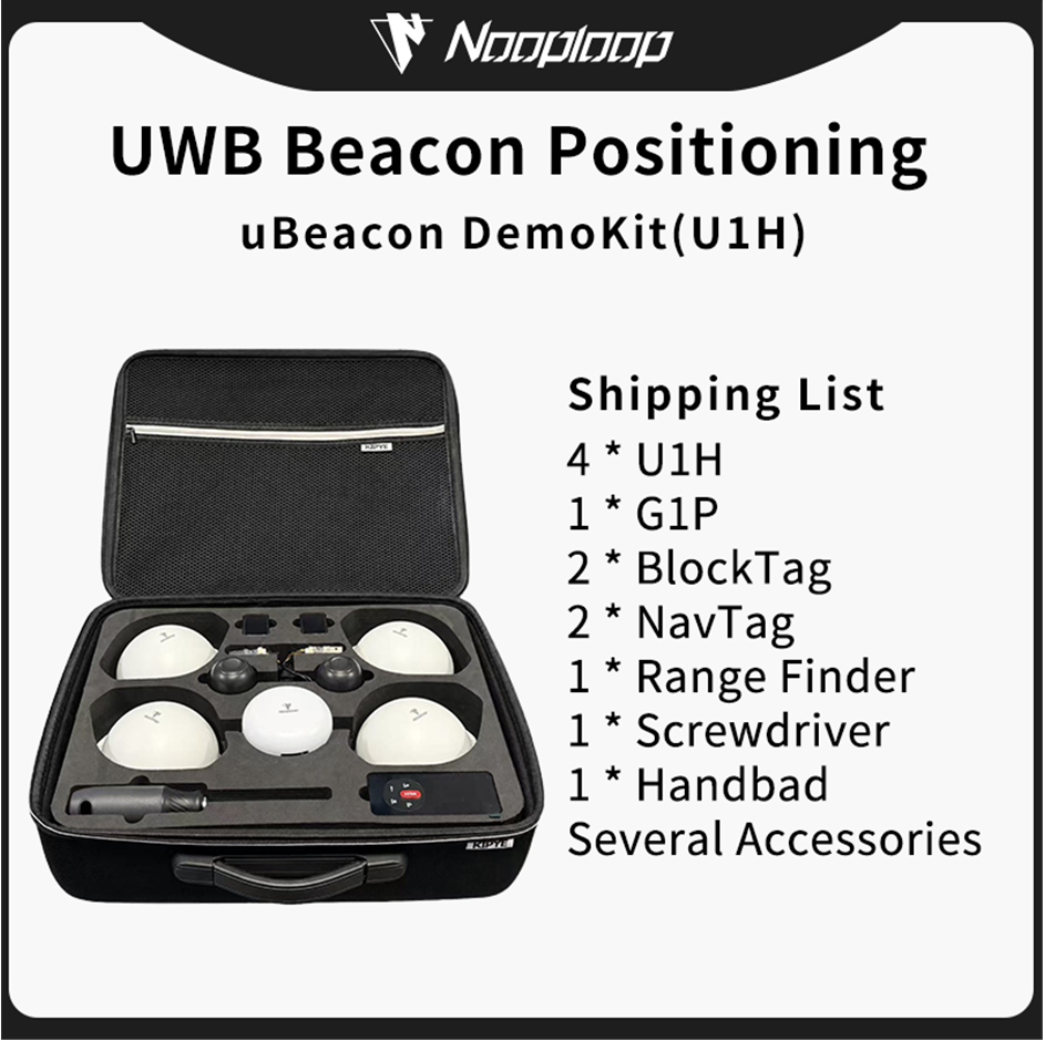
Device List
Software Installation
Refer to Software Installation
Beacon Installation
Unpack the contents. This demonstration shows the installation using adhesive pads; for other installation methods, please refer to Installation Methods
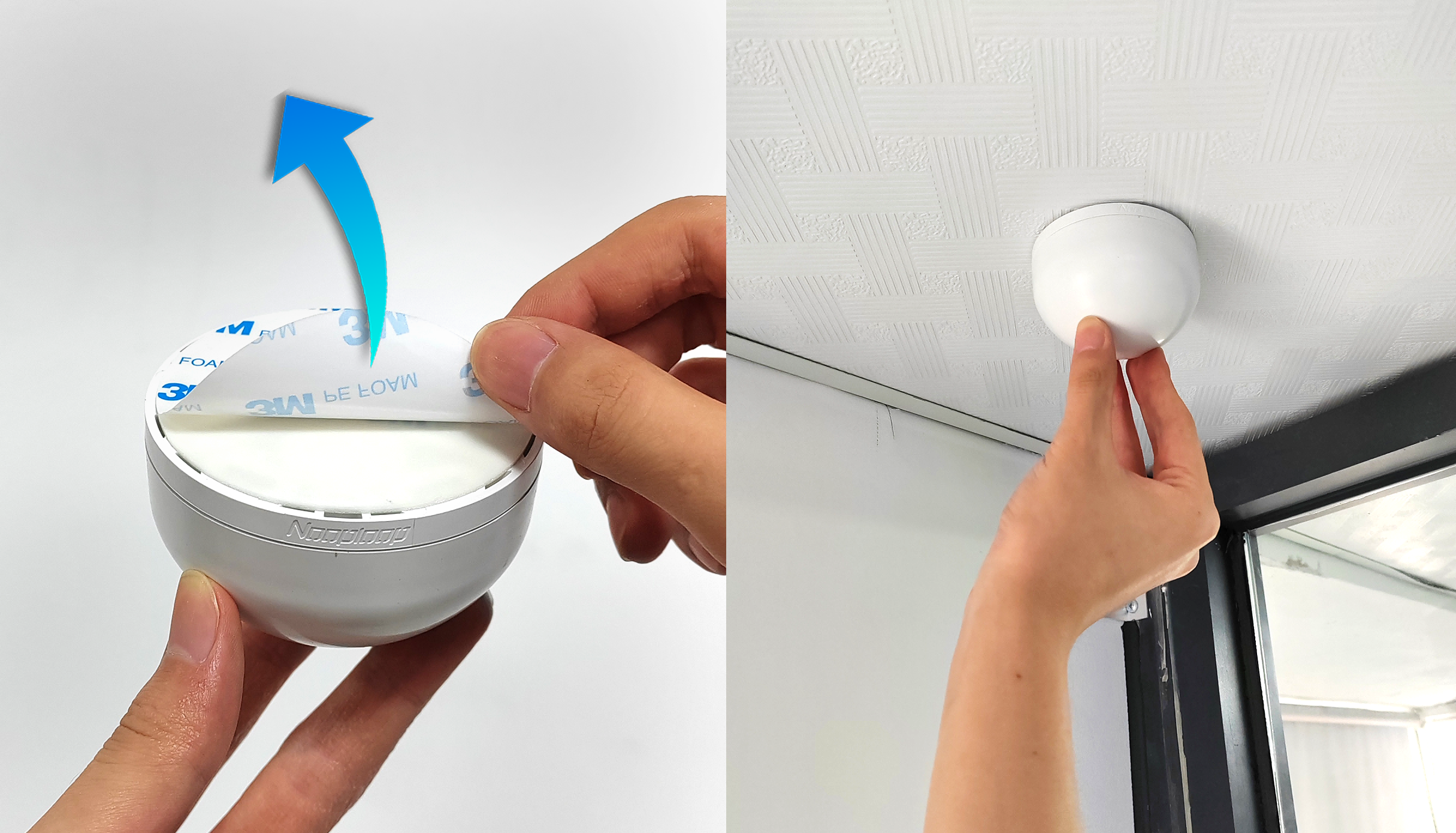
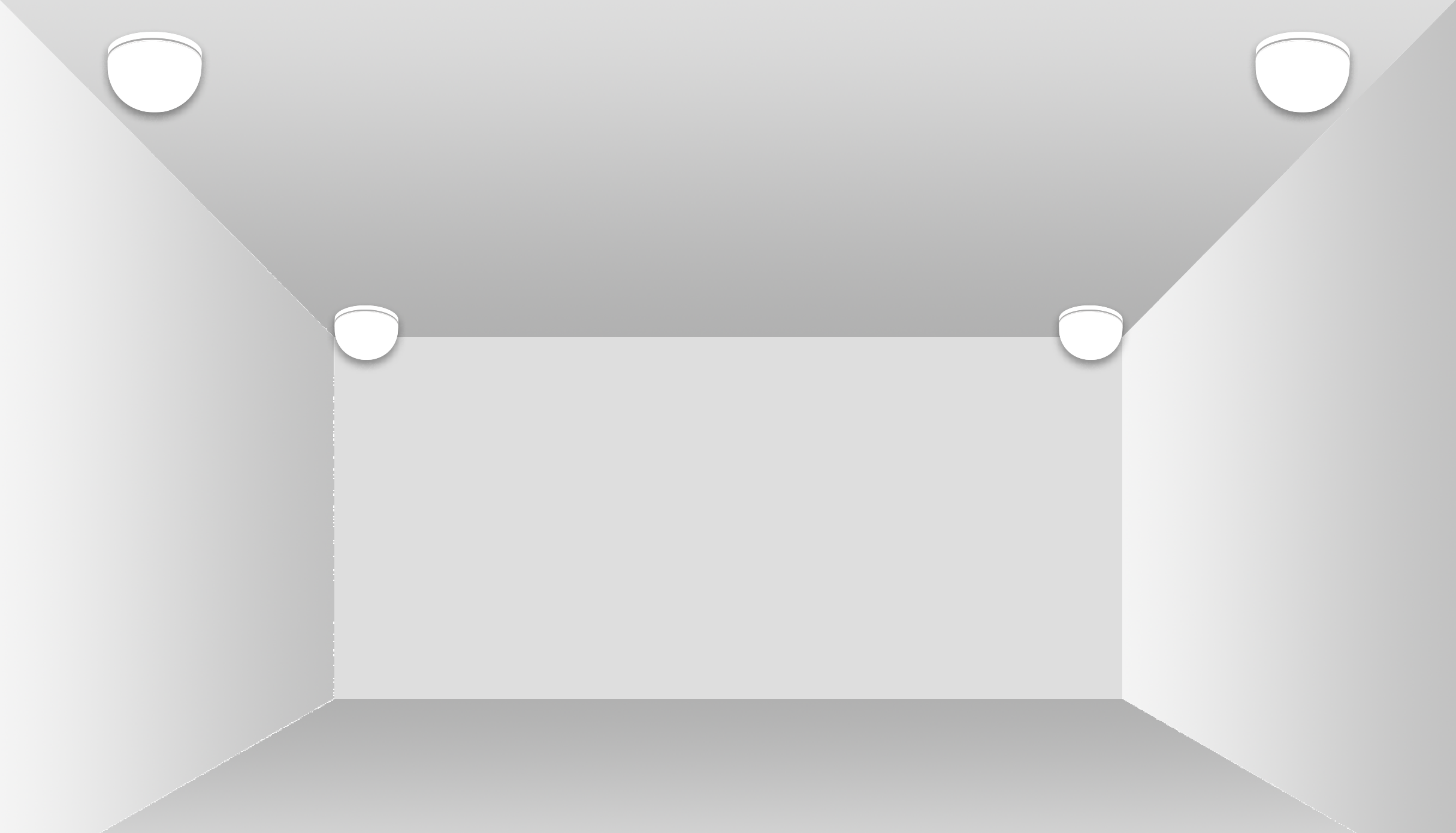
Attach the beacons to the four corners of the room's ceiling; the order does not matter.
- Recommended length and width: 5 meters or more. Positioning is possible in smaller areas, but the relative error will increase, and requirements for beacon coordinate accuracy and obstruction will be higher.
- The higher the better; if the height is too low, the beacon and tag will be more susceptible to obstruction.
Beacon Deployment
Beacon Deployment Steps:
1.Beacon Installation Complete
2.Connect the gateway to your computer using a Type-C cable or Ethernet cable, then double-click to run the uBeacon Tool software. The program will automatically open the software page in your browser.
Once the above steps are complete, you can deploy using one of the following three methods
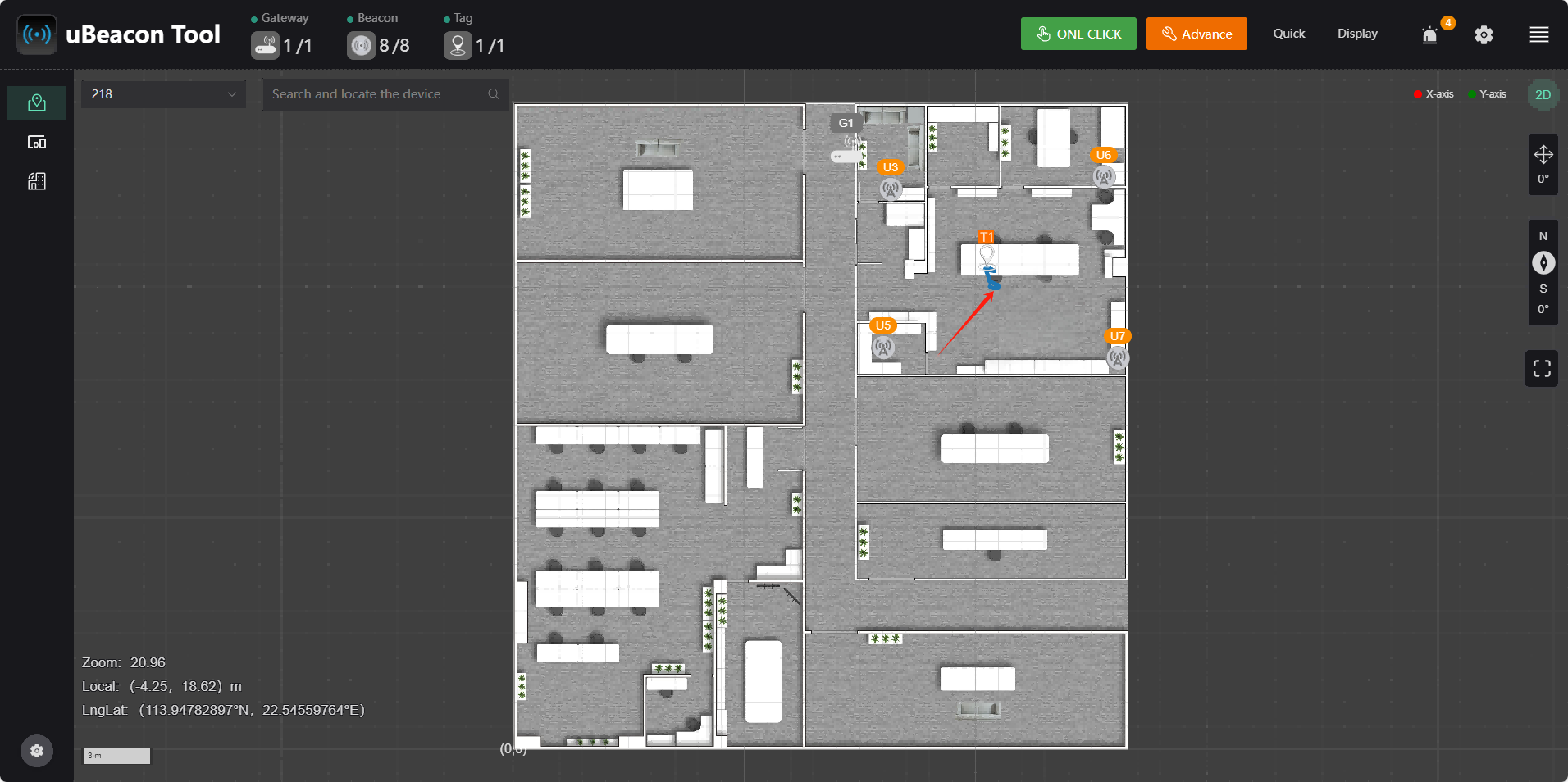
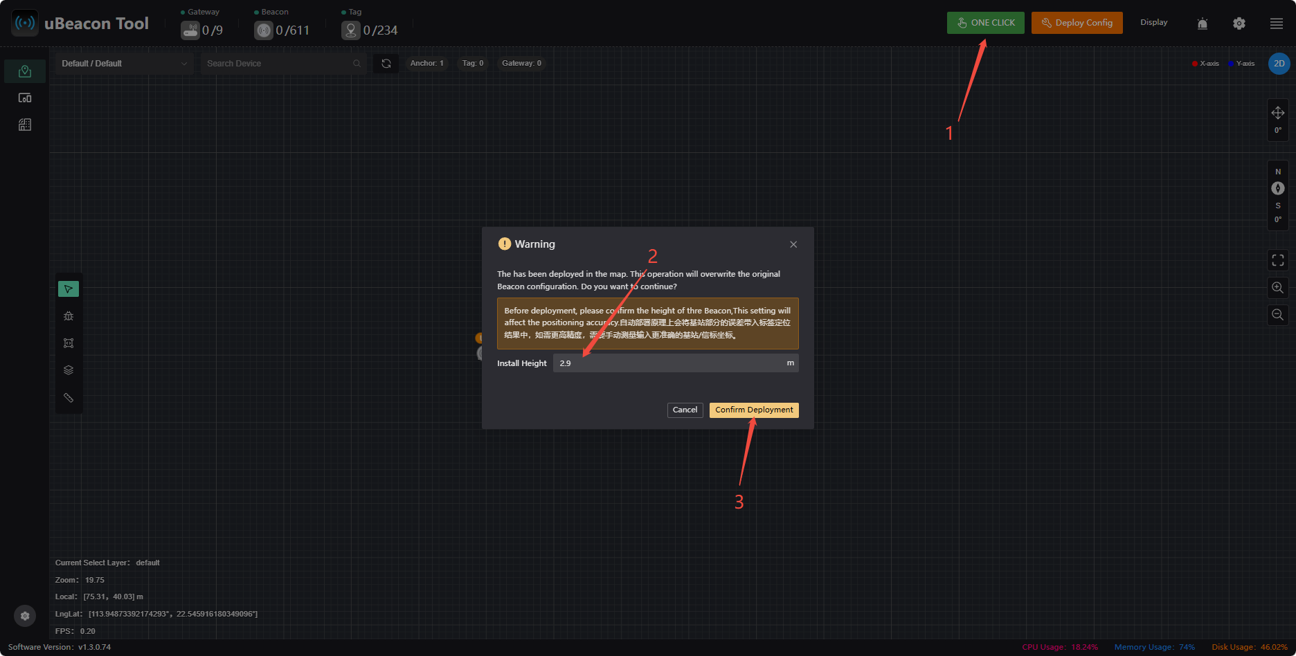
One-Click Deployment
Simply click the 【One-Click Deployment】 (2–9 beacons) button. The configured height will match the actual installation height, and the deployment is expected to take about 1 minute. There are two points to note regarding one-click deployment:
- One-Click Deployment automatically uses the beacon with the lowest UID as the origin, so the orientation of the deployed beacon may not match the actual location. If you need to ensure the beacon correctly corresponds to the actual location and orientation, you can adjust it using either Automatic Deployment or Manual Deployment.
- One-Click Deployment is subject to uncertainty; obstructions along the way may cause deployment to fail. If you require high positioning accuracy, we recommend using Manual Deployment.
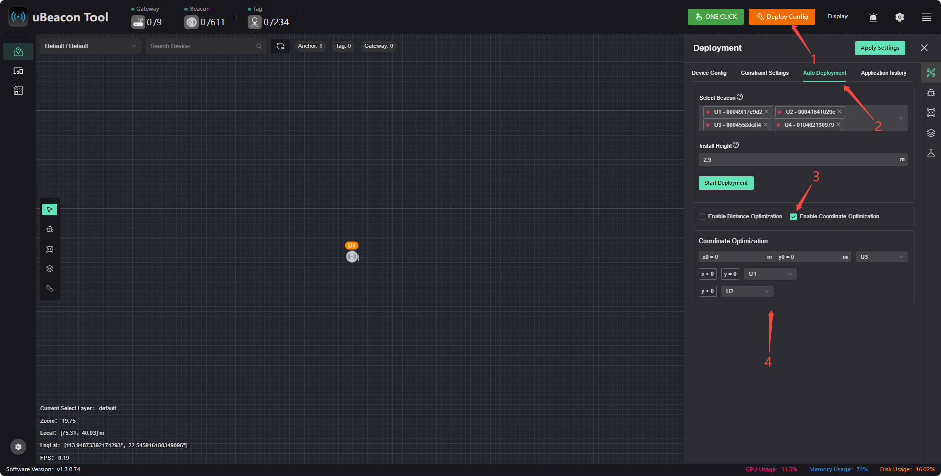
Automatic Deployment
Click 【Deployment Configuration】 > 【Automatic Deployment】, select a beacon, enable coordinate optimization, and once you’ve finished setting it up, click 【Start Deployment】 to complete the deployment.
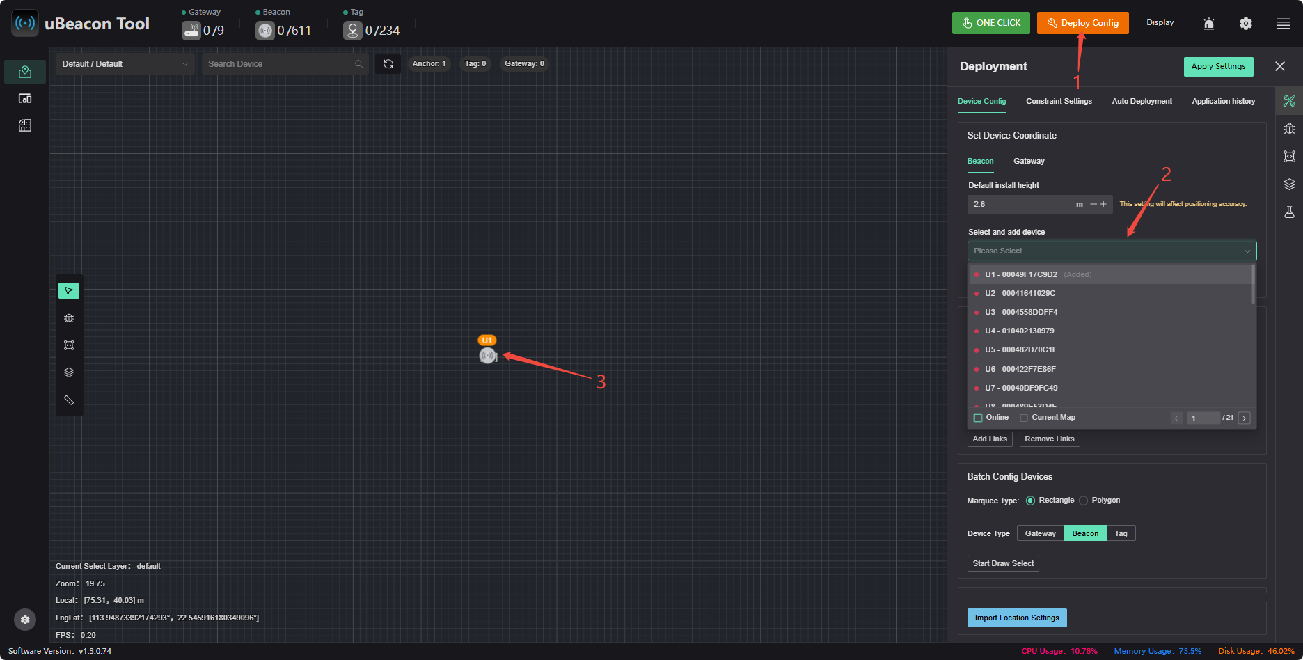
Manual Measurement and Coordinate Deployment
Click 【Deployment Configuration】 > 【Device Configuration】, select a device to add, and tap it on the map to add it. Tap a beacon on the map to edit its coordinates.
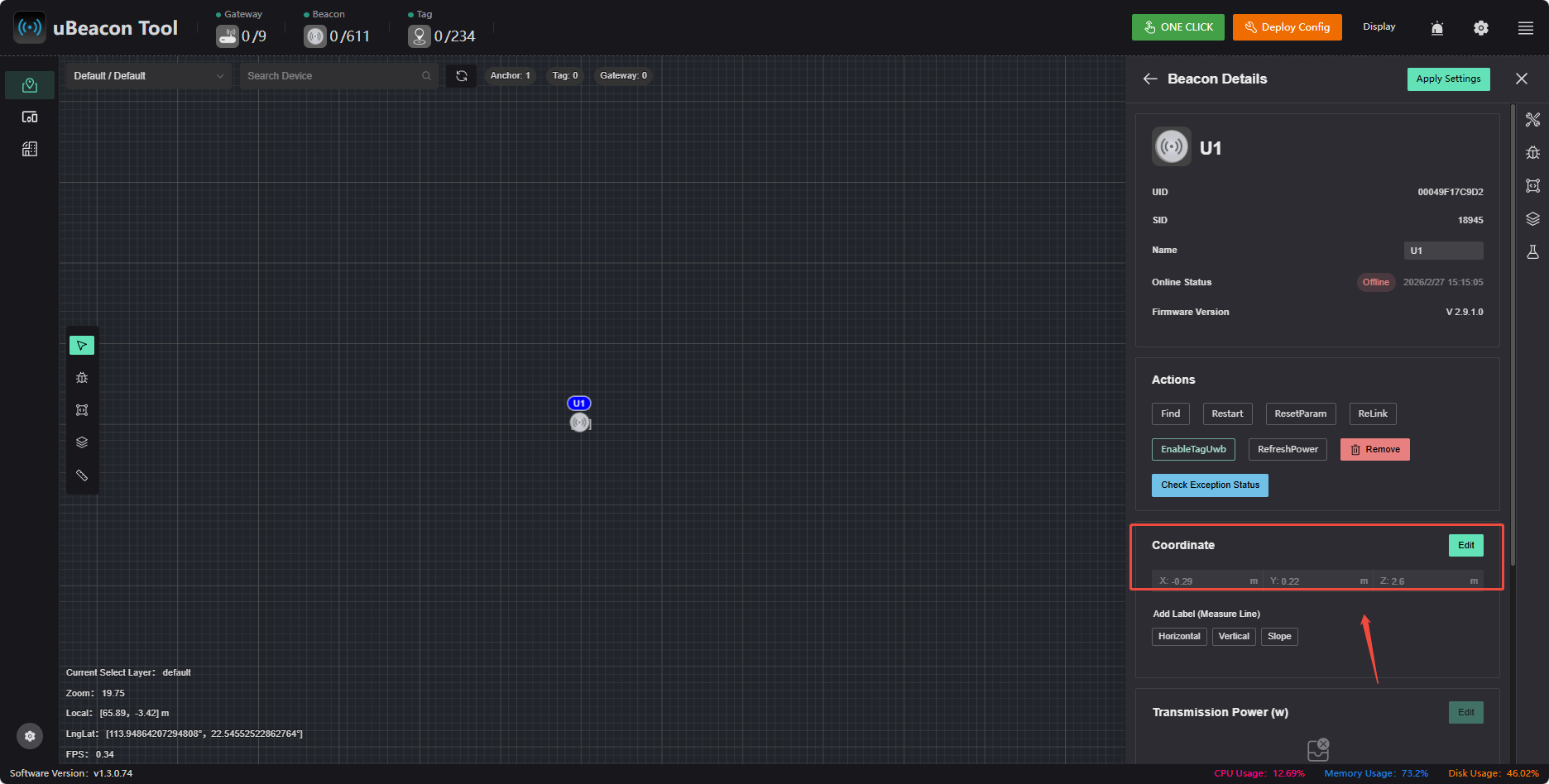
After editing the coordinates, select the links to add, then click 【Application Settings】 to complete the manual deployment. For information on beacon link relationships, see Beacon Link Relationships
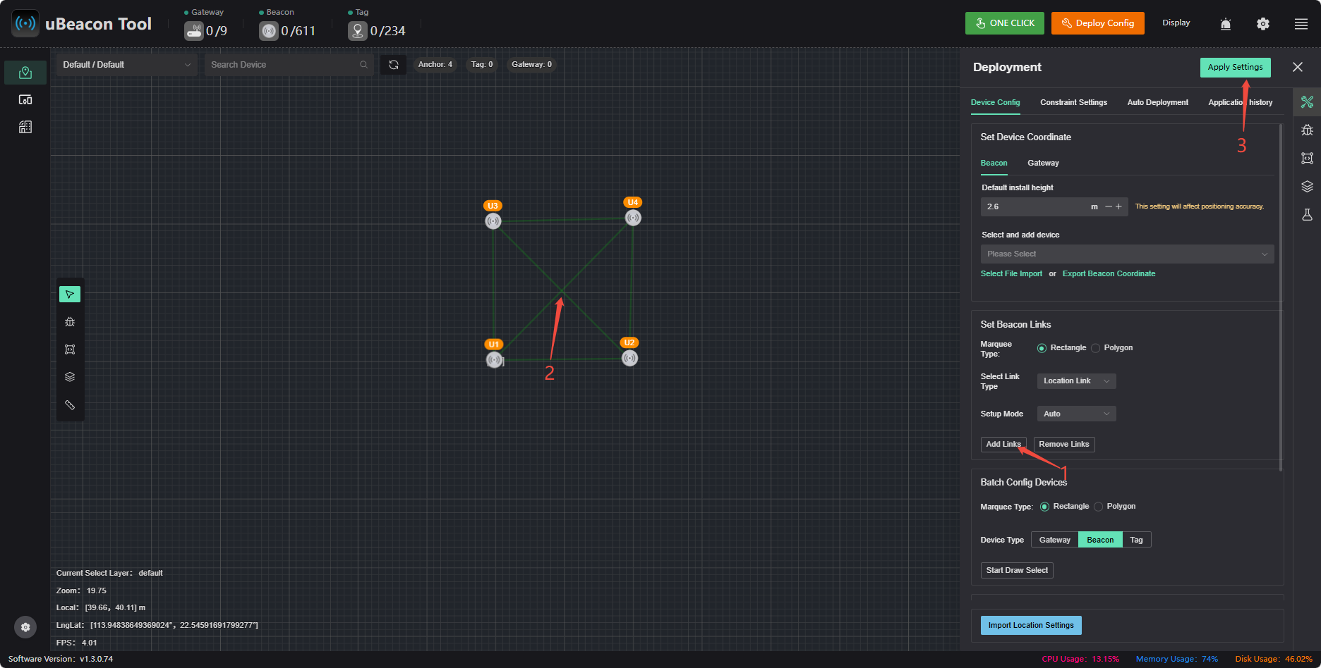
Coordinate Measurement Methods
Meaning of Beacon Coordinates: The x and y coordinates of a beacon represent its horizontal and vertical distances, respectively, from the map origin (0,0).
Case A: Direct Measurement to the Origin
If the beacon has a direct line of sight to the map origin, simply use a tape measure or rangefinder to measure the distances from the beacon to the origin in the x and y directions; these two values are the beacon’s coordinates.
Case B: Direct Measurement to the Origin Is Not Feasible (Reference Point Method)
⚠️ Prerequisite: The map has been imported and configured correctly; ensure that the map coordinates of reference points match their actual locations.
When the area is large, the origin is obstructed, or direct measurement is impractical, you can select a reference point with known coordinates (such as a wall corner or a pillar). By measuring the offset distance of the beacon relative to the reference point, the software will automatically calculate the coordinates.
Instructions:
- Identify a reference point on the map.
- On-site, use a tape measure or measuring device to measure the distances from the beacon to the reference point in the x and y directions.
- Return to the software, select the beacon, and use the “Auxiliary Measurement Line” feature:
- Click 【Horizontal】 or 【Vertical】, then click the reference point to automatically generate an auxiliary measurement line.
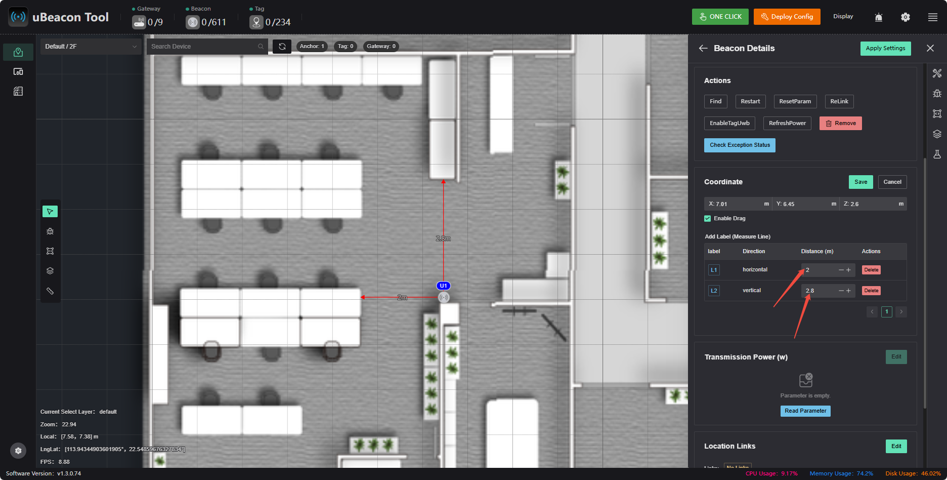
- Enter the horizontal and vertical distances measured in Step 2 into the input fields (enter the absolute values; the software will automatically determine the positive or negative signs based on the direction of the measurement lines).
- After entering the values, the software will automatically calculate the beacon’s coordinates.
- Measure the beacon’s installation height (Z) directly with a distance meter.
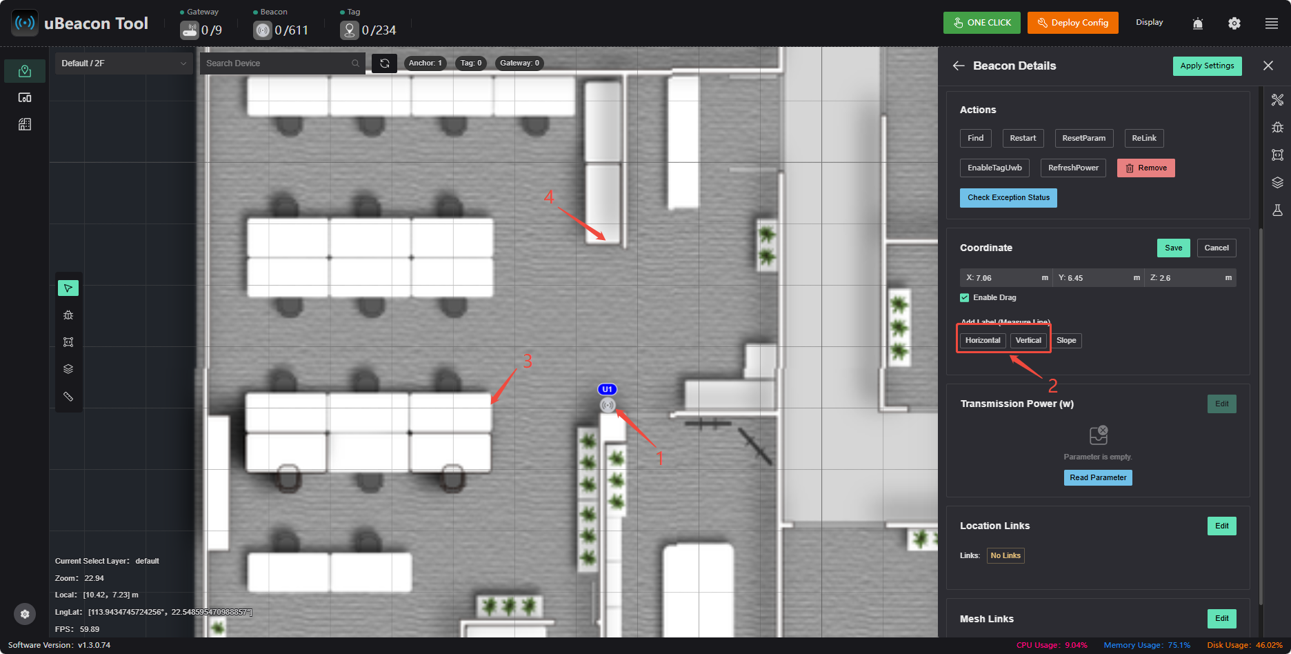
Example (see figure below):
- Using the corner of the desk as a reference point, measure the distance from the beacon to the left corner of the desk (2 m) and to the upper corner of the desk (2.5 m) using a tape measure or distance meter.
- In the software, enter
2for the horizontal distance and2.8for the vertical distance. - Once entered, the beacon’s coordinates are automatically calculated.
Testing and Positioning
- Walk around within the beacon's range while holding the tag and the computer, and observe the positioning results
- If the coordinate systems do not align, right-click to rotate the corresponding coordinate system for testing